
Map Boundaries
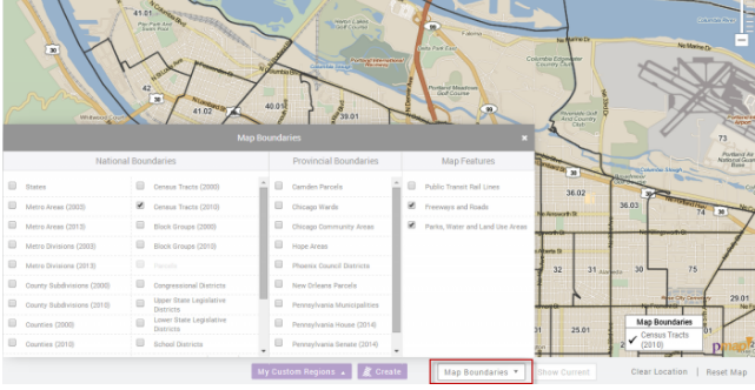
Did you know you can overlay geographic boundaries like zip codes, census tracts, or block groups? Select the Map Boundaries button on the bottom of the map. This will open a panel with boundary choices. Your zoom level will determine which boundaries are available to overlay and some are only visible to their respective location.

Premium subscribers have the option to send unique boundaries for their regions. Boundaries that can be used by the public will be added to the Map Options under Provincial Boundaries. Some of the regional boundaries include; city councils, planning, or even community areas. Contact us if you have regional boundaries that you would like to include onto the platform.
Subscribers can overlay transit rail lines for over 140 cities across the country. This data layer will show the rail system and also give information for each stop like; handicap accessibility, fare vending machine, parking options, and much more.

Read our Quick Start Guide to learn the basics of PolicyMap and jump right into using the power of data.
If you wanted to know more about a feature or topic, send your request to info@policymap.com subject “Tutorial Topics”.