
Customizing Custom Regions

Did you know subscribers can change the color of custom region boundaries and also fill in the area of a custom region. If you remember, custom regions allow users to draw right on top of the map and create unique target areas that can cross any geographic boundaries or group together pre-define geographies. Custom regions can then be used in Tables to download data for the area or into Reports to generate aggregated reports.
After creating a custom region, select the (![]() ) icon to open a menu of features (see image below) you can take action on with a custom region. Users can still open a custom region in Tables, Reports, or even Share with other subscribers. Custom regions also have the option to change the color of the border and even fill in the area covered by the region.
) icon to open a menu of features (see image below) you can take action on with a custom region. Users can still open a custom region in Tables, Reports, or even Share with other subscribers. Custom regions also have the option to change the color of the border and even fill in the area covered by the region.
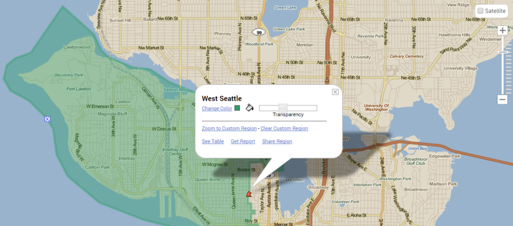
- Select “Change Color” or (
 ) icon to open a menu of color options (see image on right) that users can now change the custom region border color or area filled in with.
 - Click onto the (
") ) bucket icon and the custom region area will fill in with the color selected. Click the bucket again to remove the fill and just show the colored border.
) bucket icon and the custom region area will fill in with the color selected. Click the bucket again to remove the fill and just show the colored border. - The “transparency” slide bar allows users to adjust transparency of the border or filled in area of a custom region. This is a great option when overlaying multiple custom regions with areas that might intersect.

After customizing custom regions with the new color options, users can also generate a printout with colored custom regions displayed.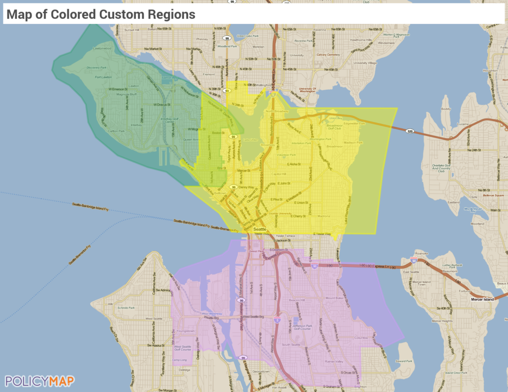 This gives your “target area” greater presence on a map. Just remember to check that the color used on a custom region does not match the color palette of thematic data. Otherwise, the custom region could blend into the thematic layers.
Be sure to check the links for each unique feature in the Custom Region Overview. If you have any questions or want to lean more, visit our training calendar and attend a free session or contact us at any time.
To read a full guide on all features on PolicyMap, please look at our Primer available here