
A Quick Guide to Geographic Place Codes (PART III)
By now you should be fully schooled in how to identify a state and county by its numeric FIPS code. And so, we move down in scale to a more local geography.
State/County FIPS codes can be further paired with census tracts and block groups. These two subsequent geographies are nested within the larger regions using a 12-digit numeric code; state (00) county (000) census tract (000000) block group (0).

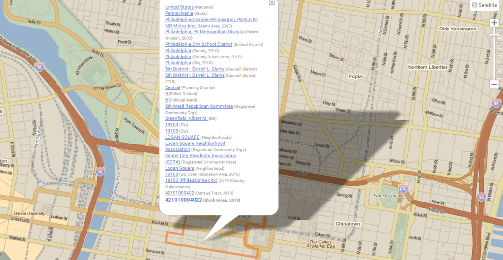
So, here at PolicyMap our offices are located in the block group identified as ‘421010004001’. Pennsylvania (42)-Philadelphia (101)-Tract 4(000400)-Block Group 1(1). Census tracts may appear less than intuitive to interpret. A tract number is a 6 digit number, with 2 digits after an implied decimal. Tract 4 would technically read, ‘0004.00’. The first 4-digits identify the tract, with leading zeros for smaller values, while the trailing zeros are generally used to identify changes and often divisions within the tract. The U.S. Census Bureau will divide a tract when the population increases, but may decide to maintain the core 4-digit identifier. So, if tract number 1208 splits, it may go from ‘1208.00’, to ‘1208.01’ and ‘1208.02’. Block groups luckily are less complex. The single digit number is appended to the end of the code, specifying an even smaller subdivision of the census tract.
What FIPS code do you live in? You can find a FIPS code by searching for an address on PolicyMap and then simply clicking to identify an area on the map. When the info bubble pops up, a hierarchy of geographies is listed from largest to smallest. Listed at the bottom is that 12-digit code that you are now an expert on!
