
What does a Superfund site look like?
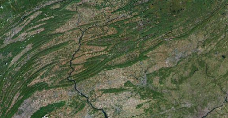
The other day, I was map-gazing at the beautiful Blue Mountain ridge that extends from Maryland all the way up to upstate New York. Along the way, it’s known as Broad Mountain in Marland, the Kittatinny Mountains in New Jersey, and the Shawangunk Ridge in New York, where it’s known locally as “The Gunks”. On the image below from Google Maps, it’s the leading ridge extending from corner to corner.

Sites along the ridge include the Delaware Water Gap, the Susquehanna River, and the Pinnacle:

The Delaware Water Gap

Susquehanna River

The Pinnacle
But looking at the ridge, I soon came across something less pretty, near Palmerton, Pennsylvania:

A closer look shows the ridge stripped of trees:

Wondering what was going on, on a hunch, I went to PolicyMap, and opened up the Superfund site locations map alongside the aerial image of Palmerton:

Sure enough, this is the site of the “Palmerton Zinc Pile”. Further research at the EPA website lists Blue Mountain as one of the areas of concern, listing it as “the defoliated north slope near the east plant.” The Appalachian Trail goes straight through the site. According to the EPA, aircraft will be used to drop seeds to re-vegetate the area near the trail.
PolicyMap’s Superfund dataset and Brownfields dataset were just updated, so you can look up environmental cleanup efforts in your area. Remember, just because there’s an environmental cleanup near you doesn’t mean your health is at risk; check the EPA and local authorities for more information.