
More Precise Broadband Availability Data
 A few months ago, we introduced a shiny new dataset onto PolicyMap, broadband internet access data from the National Broadband Map. It introduced a lot cool indicators, like availability of different technologies (DSL, cable, fiber, wireless), highest available speed, and number of competitors in the local market.
We’ve now made a major improvement to this data that should make it significantly more useful than before.
When we originally released it, the data was summarized at the block group level, so if a block group had broadband availability anywhere inside, we showed it as a block group that has availability (and this was explained in our methodology). Census block groups are the smallest geography type we generally show data for, and are usually small enough to only have populations of 600 to 3,000 people. Usually, this is great for the kinds of data we show. Unfortunately, broadband access is unique, because there are often small pockets within block groups that don’t have access. More importantly, block groups in rural areas can be very big. And it’s in these rural areas that broadband availability can be most spotty.
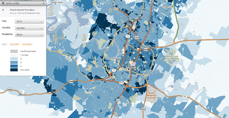
So, after a little work here, we’re now able to show broadband availability data at the census block level. Blocks are even smaller than block groups; in cities they’re something like a city block, in rural areas, they’re generally bounded by roads and land features (streams, hills, etc.). Blocks are much smaller than block groups, and will provide much more precise detail when it comes to broadband availability.
See the difference it makes:

And particularly in rural areas:

Why didn’t we do this before? This is the first time PolicyMap has ever shown census block level data. Because the blocks are so small, the boundary data is ten times bigger than it is for block groups, our previous smallest boundary. It required some work to make sure that when you look up data on internet access, it doesn’t crash and take PolicyMap off of the internet.
Because blocks are so small and there are so many of them, you have to zoom in a good bit to see the data. You can see availability in a region around a city, but not for the whole country.
Enjoy this new data, and let us know what you think!