
Data for Small Business Week: Are You in a HUBZone?
We’re celebrating Small Business Week at PolicyMap by featuring data on PolicyMap that is particularly useful to small businesses. Today, we’re taking a look at HUBZones.
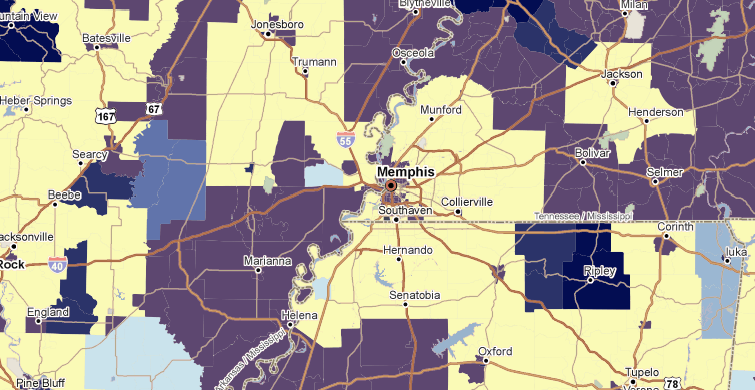
Historically Underutilized Business Zones (HUBZone) is a federal program from the Small Business Administration that helps small business in some urban and rural areas get preferential access to federal procurement opportunities. As you might have guessed, in order to qualify, your business needs to be within a HUBZone. HUBZones are defined by a hodgepodge of various government designations, including Qualified Census Tracts, Qualified Nonmetropolitan Counties, Qualified Indian Lands, Qualified Base Closure Areas, and “redesignated areas”. Fortunately, PolicyMap has a HUBZone map.
PolicyMap’s HUBZone map includes Qualified Census Tracts (QCTs), Qualified Nonmetropolitan Counties (QNMCs), and redesignated areas. The other two are not included due to their changing nature, but fortunately, it’s likely that a small business applicant knows if it’s in Indian land or on a former military base.
Redesignated Areas are former QCTs and QNMCs that would otherwise no longer be HUBZones, but are grandfathered in. Some redesignated areas expire every year. For this reason, on PolicyMap, they are shown with a different color, indicating when each area will expire.
HUBZone data can be accessed on PolicyMap in the Federal Designations tab, under Federal Incentive Designations.