Ensure the future direction of your library is consistent with the needs of your community.
Public libraries face the challenge of meeting the evolving needs of their communities while planning for the future. PolicyMap offers access to thousands of data points, equipping library leaders with the insights to make strategic, informed decisions.
From grant applications and strategic planning to collection development and programming, our platform helps libraries align their services with community priorities, ensuring greater efficiency and effectiveness in meeting public needs.
Zoom in to find your library and service area.
Trusted by hundreds of public libraries, and counting


REQUEST A DEMO
See PolicyMap In Action
Ready to plan for your library’s future? Request a personalized demo to learn how PolicyMap helps improve collection development, strategic planning, grant applications, community programming, and more.
Who We Help

Library Leadership
Library directors and leadership rely on PolicyMap to inform collection development, develop strategic plans, improve grant applications, community programming, and more.

Library Consultants
Consultants can conduct in-depth community assessments, identify service gaps, and provide actionable recommendations for libraries to enhance their impact.

Library Patrons
With a dedicated tool, PolicyMap for Public Library Patrons enables cardholders to explore community data independently via onsite or remote access. Download more information here.
How We Help
Understand Your Community Through Demographic Data & Beyond
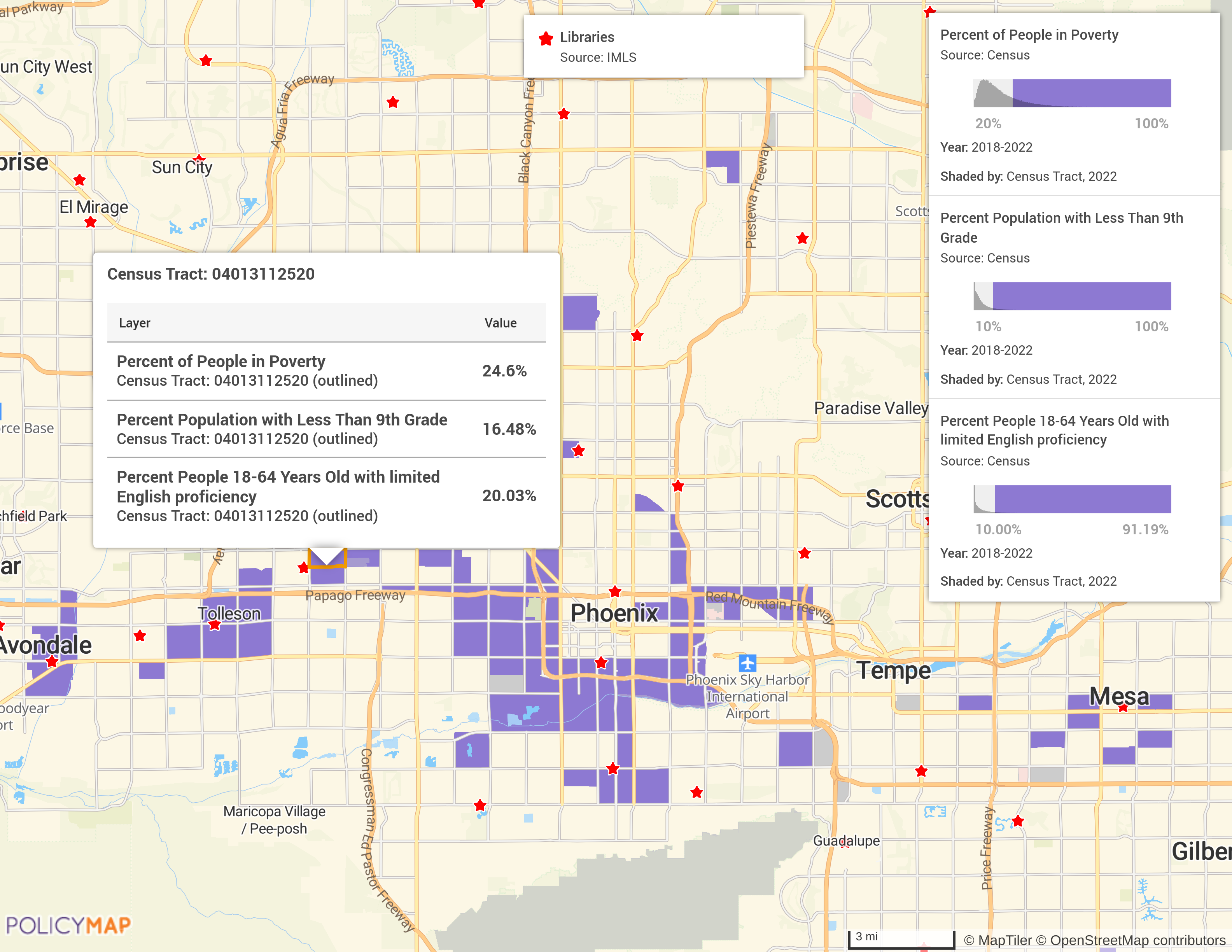
Use our platform to understand the people who live, work, and engage within your library service area. PolicyMap provides access to data on age, race, ethnicity, family structure, and income levels, plus information on community needs such as internet access, food insecurity, or housing conditions. These insights can help guide services, programs, and resource allocation to better align with your community.
PolicyMap is key to accurately and effectively describing the need in our County. There is no way I can track this alone.
–Hillary Theyer, Library Director
Monterey County Free Libraries
Smarter Budgeting, Bigger Impact
Plan budgets that reflect your library’s mission and make a lasting impact. Easily identify funding priorities and optimize spending based on a detailed understanding of local needs.
For example, Monterey County Free Libraries staff use PolicyMap as an effective strategic planning resource.
Analyze Cardholder Engagement
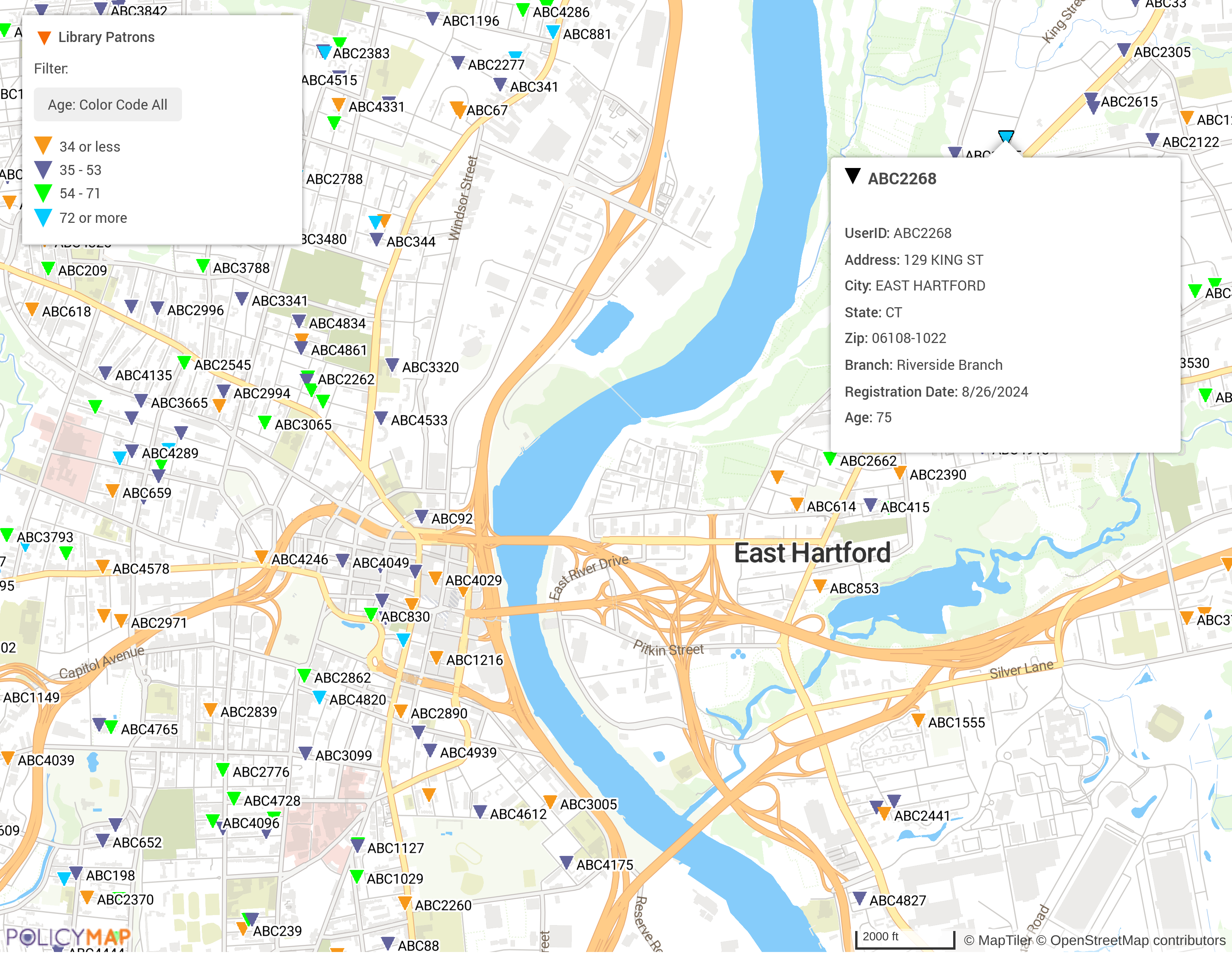
Upload your library’s patron data to uncover trends and engagement patterns. Discover who’s using your resources and how to better connect with underserved audiences. For example, learn how libraries can use PolicyMap to plan bookmobile stops.

We were able to pinpoint communities in our state that were facing significant challenges, such as high unemployment rates, limited English proficiency, and low educational attainment. This targeted approach allowed us to allocate our grant funds more effectively, ensuring that resources were directed towards those who needed them the most.
– Jennifer Nelson, State Librarian
New Jersey State Library
Strengthen Grant Applications
PolicyMap is a powerful tool for library grant writers, providing access to a vast repository of data to support compelling applications. Highlight your library’s community impact and organizational vision with precise maps and insights. Secure the funding you need to expand services and meet the evolving needs of your community.
Plan for the Future
Library leadership and consultants can access robust tools for assessing community needs and creating strategic plans. Use data to pinpoint opportunities for program development, partnerships, or expansion. Build a future-focused library that serves as a cornerstone for your community. For example, consultants at ReThinking Libraries leverage PolicyMap for strategic planning and community needs assessments.


Empower Patrons with Community Insights
Enhance your library’s role as a trusted community resource by providing patrons with access to relevant local data. From researching demographic trends and workforce characteristics to exploring socioeconomic factors and consumer spending habits, our platform makes it easy for patrons to find valuable insights. Click here to download more information on PolicyMap for Library Patrons.
Subscription Options
Maps, Data, Analytics, Reports & Dashboards

Mapping Platform
cloud-based; annual subscription for individual, team, or enterprise

Bulk Data Delivery
via flat file, API, or Snowflake

Embedded Maps
add our maps and data to your website

Partner Portal
provide access for your partners or members

Curated Collections of Data
Social Determinants of Health, Clean Energy

Insights & Client Solutions
consulting and custom development
WEBINAR
PolicyMap for Libraries:
Mapping, Data, and Community Impact
Learn how to use PolicyMap to understand your library district, generate community profile reports, customize data layers, and explore updated Census demographics. Discover ways to address community needs, from digital equity and school partnerships to food insecurity and public transit access, using tools like the Social Vulnerability Index.
Developed In Partnership With


BROCHURE
How to Align Library Services To Community Need
Unlock more information about our data and sources.
