
Kentucky Department for Public Health: PolicyMap for Preparedness
The Kentucky Department for Public Health is one of PolicyMap’s newest subscribers in the public health realm. The Public Health Preparedness office uses PolicyMap’s health and demographic data offerings to provide useful information for citizens and practitioners.
Health Risks and Resources
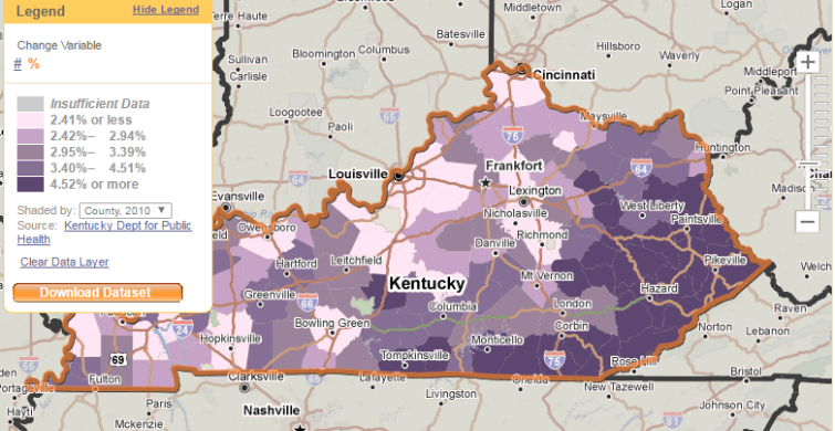
Kentucky Public Health developed its Health Risks and Resources map to give local public health personnel greater knowledge of population characteristics to facilitate response to vulnerable populations in case of an emergency. By overlaying health resources with needs, public health practitioners can increase their awareness of challenges well before an emergency occurs. Visit the map at the Kentucky Safety and Prevention Alignment Network to learn more.

About the Widget
The Kentucky Department for Public Health loaded the locations of key preparedness resources and healthcare providers, including emergency management offices, long-term care facilities, and dialysis centers. Also featured on the widget are PolicyMap data points showing hospitals, retail-based healthcare, and Federally Qualified Health Centers. Kentucky Public Health’s widget utilizes data from the American Community Survey, and also incorporates statewide, county-level data from several Kentucky agencies. Layers from the Renal Network, Kentucky Office of Health Policy, and Kentucky Department for Behavioral Health & Intellectual Disabilities show estimates for counties’ population with dialysis dependence, long-term care population, and mental or cognitive impairment. The department provides map users with a detailed matrix of the data layers and sources (pdf).
Learn more about how to get a custom widget on your site here.