Newsletter: July 2022

Man with Asthma using inhaler


Access Local Health Data with CDC PLACES

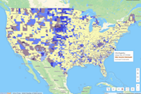
Looking for better local health data? You can now analyze population-level health conditions and risk factors and estimate community health measures at the City, County, ZCTA and Census Tract level.

Now available to our premium subscribers, the CDC PLACES dataset replaces, updates, and improves upon two of PolicyMap’s previous datasets: our custom Small Area Health Data dataset, and the CDC’s 500 Cities dataset.

Read More


  ON THE BLOG
 
 
3D Building Footprints  

3D Building Footprints Now Available for More of the US

Did you know that PolicyMap users can visualize 3D building footprints when making maps? Dig deeper into neighborhood-level data with interactive visualizations.

Read More
 
CRA Eligible Tracts  

CRA Eligible Tracts and Tract Median Family Income

PolicyMap has now mapped Community Reinvestment Act (CRA) eligible tracts and tract median family income.

Read More
 
HOLC Boundaries  

Helping CDFIs Locate Equitable Recovery Program (ERP) Eligible Areas

Data on the new Equitable Recovery Program from the CDFI Fund is now available. With this new data, PolicyMap can help CDFIs identify where future investment will need to take place in order to compete for this funding and determine how much of their historic activities have taken place in these areas.

Read More


  CUSTOMER STORIES
 
 
RIHousing Logo  

[Updated] Rhode Island Housing

RIHousing’s Embedded Mapping Tool is now on the new version of PolicyMap. The interactive map allows users to explore RIHousing program and local Census data and generate reports on the impact of investments in Rhode Island communities.

Read More


Updated Data


CRA Eligibility and Tract Median Family Income as % of Area Median Family Income from the FFIEC are updated in PolicyMap to 2022. They are available to all users under both the Lending and Federal Guidelines menu. The CRA Eligibility layer shows census tracts that meet FFIEC’s definitions of low or moderate income or middle income distressed and underserved. And the Tract Median Family Income as a % of Area Median Family Income layer is also available as it serves as a primary criteria in determining CRA Eligibility. [NOTE: This represents the most substantial change to these layers in PolicyMap in years. This is the first year these layers will be displayed at 2020 Census Tract boundaries. Eligibility determinations now rely on underlying income data from the 2016-2020 Census ACS.]
 

Data from the CDC’s PLACES program is now on PolicyMap. The data contains estimates of chronic conditions such as high blood pressure and kidney disease, and risk factors such as smoking at the Census tract, ZCTA, city and county geographies. Available to premium subscribers.
 

The locations of projects that used the Low-Income Housing Tax Credit program from HUD has been updated to 2020. The point data can be filtered by year placed in service, construction type, credit percentage, and more. Updated yearly and available to all users.
 

Low and Moderate Incomes (LowMod) has been updated to 2016-2020. These layers are calculated by PolicyMap using Income Limits data from HUD and income data from the ACS. The layers show Median Household Income and Median Family Income for Census Block Groups and Tracts as a percentage of the Area Median Household or Family Income. This data is updated yearly and is available to all users.
 

Data on the new Equitable Recovery Program (ERP) from the CDFI Fund is available on PolicyMap. The layers show areas eligible for grants from the CDFI Fund to assist with recovery from the COVID-19 pandemic, along with the criteria for eligibility. Data is available to all users.
 

[FEATURES UPDATE] The legacy version of PolicyMap will be sunset at the end of October. Contact us to learn more.
 

We are committed to our promise of curated, cleaned, standardized, and always updated data. We’re posting real-time updates on our website and Twitter.


In case you missed it
 

We’re hiring!

PolicyMap is growing.

We are seeking an experienced, collaborative and highly organized Director of Data Analytics to join our team.


Love PolicyMap? Leave us a review!

We want to hear from you. Take 2-3 minutes to tell us about your experience using PolicyMap.
 

To thank you for your time and feedback, we are offering $10 gift cards.


Open PolicyMap Training Sessions

Offered twice a week. Register here.
 

Level 1: Learning the basics of PolicyMap
Level 2: Learn the Data Loader, Multi-Layer Maps, and other Advanced Features
 

Open to non-subscribers. Course times rotate weekly. Don’t see a time that works for you?
Contact us.
 
 
Upcoming Events
 

Join us!

Back To School with PolicyMap

Virtual Webinar
Tuesday, August 23rd
2:00pm EST

Hosted by:

Elizabeth Nash, Chief Data Officer
Phil Vu, Chief Customer Success Officer
Betsy Minnich, Business Development

PolicyMap is an essential classroom resource. Learn how our mapping and analytics platform can support your curriculum in the upcoming academic year. We’ll cover new and upcoming data and features, helpful support resources, and answer your questions!

Find registration information here.