
Updated Congressional Districts and State Legislative Boundaries
Earlier this week, PolicyMap shared an exciting announcement: the Congressional Districts for the 118th Congress and the 2023 State Legislative Boundaries are now LIVE on PolicyMap.
Districts were redrawn as a result of population shifts reported in the 2020 Census. It means that the voting districts for many of our public officials are different now than they were just a year ago. And, for some, the boundary change is significant. The US Census Bureau recently released the new shapefiles for these Districts and we’ve incorporated them into PolicyMap, giving you the ability to see them on a map, create comparative tables of data and understand the new population being served in these districts through on-the-fly reports.
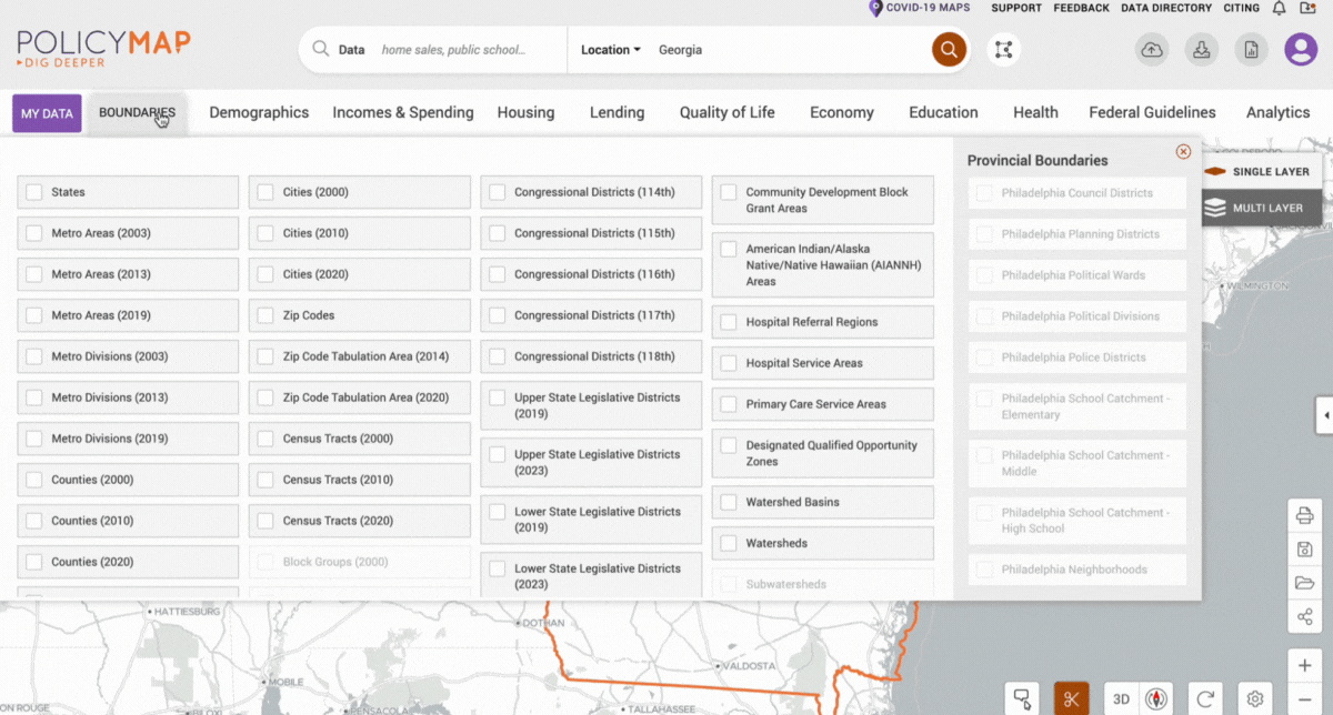
Did you know you can overlay legislative district boundaries on PolicyMap, in addition to geographic boundaries like zip codes, census tracts, or block groups? To select a boundary, click ‘Boundaries’ next to ‘MY DATA’ in the top left of the PolicyMap application. This will open a panel with boundary choices. Your zoom level will determine which boundaries are available to overlay.
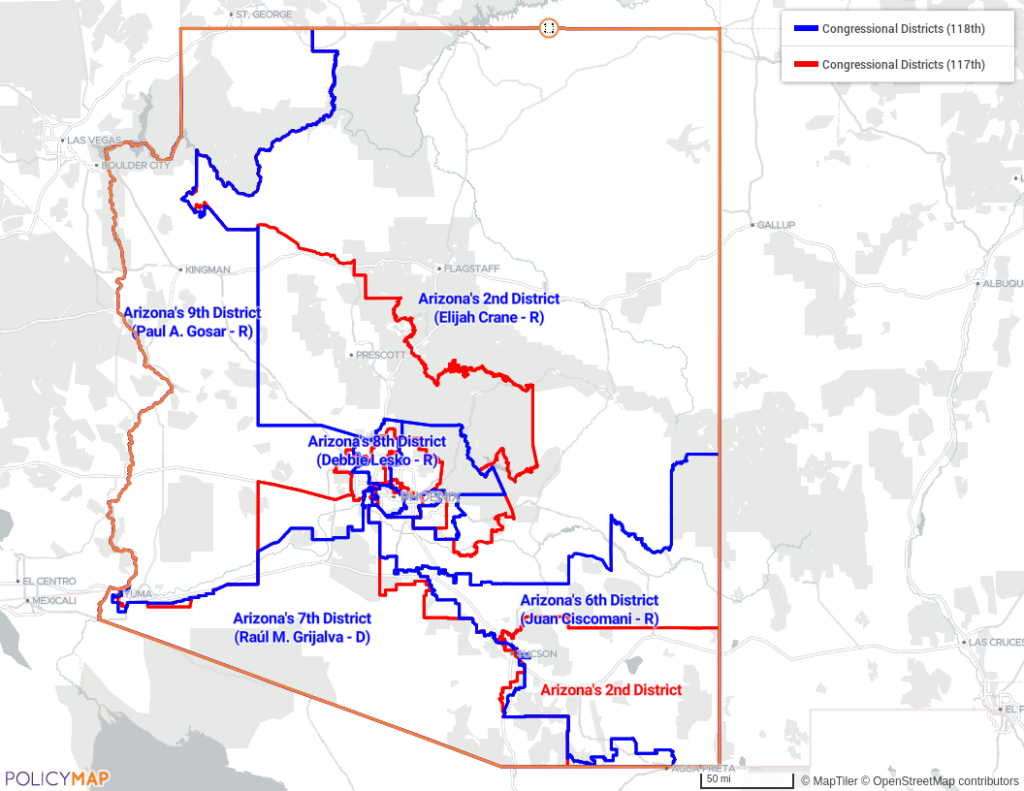
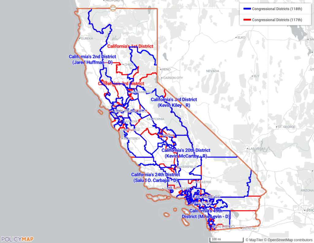
The maps below show changes between the 117th and the (newly released) 118th Congressional Districts in Arizona (top image) and California (bottom image).
Need help using PolicyMap’s features? Check out our twice-weekly trainings. Interested in learning more about our mapping platform, data licensing, and pricing options? Inquire here.