
Map Printing Upgraded on PolicyMap
We’ve just released a major upgrade to the print/export image feature on PolicyMap, which improves the quality of the image file, and gives you more control over the contents of the map. Let’s get right to the new features:
Higher Resolution Full-Page Prints

The maps now export as higher resolution PNG and PDF files, showing smoother images and easier to read text. Previously, the maps looked decent when you printed them on paper, but the images on the screen looked a little jagged. Now the same high quality image you see online you get in the downloaded file. Just a note with this: printing high-quality maps and graphics from the web is hard to come by; this higher-res print improvement is unique to PolicyMap, and building it has been a labor of love.
Print Preview Box

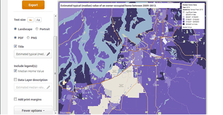
Now you can make sure the exported image shows exactly what you want it to show. After you click on “Print”, you can pan and zoom within the print preview dialogue, as well as make a number of customizations to the other aspects of the file.
Let’s say you were making a map of Bridgeport like in the screenshot above, but once you see what the export looks like, you want more Bridgeport and less Long Island Sound. Just zoom in and drag the map down a bit.
Adjustable Font Size
Sometimes, you want the map to speak for itself. Sometimes, it’s helpful to have the text around the map be a little bigger, depending on how you want to use it, and who’s going to see it. If you’re going to insert the image into a Word document, and it’s likely to shrink a little bit, larger text might be helpful. If you’re going to use it in a PowerPoint slidehow in a large room, larger text might be helpful. If you’re printing it for someone who doesn’t always carry their reading glasses around, larger text might be helpful.
Editable Title and Description

If you want to be more specific or creative than the default title of the map, give it your own name. You can optionally add a description of the data, and customize it, if you want a little of both:

Optional Print Margins for Printing or PowerPoint

The map can take up almost the whole 8.5×11 file, or you can add white margins around the edge for more traditional printing.
Like before, you’ll have the option of printing a PDF file or a PNG file. PNG files are similar to JPGs, and can be used in almost all places where you can use JPGs.
One other small change to note: After you print, the actual file and map will no longer be automatically saved in the My Saved Work section. If you want to save your map, just click on the Save icon in the top right corner.
Printing is available to all registered users, so if you’re not registered, you can sign up for free.
We hope you like this new functionality as much as we liked building it!