
Get out the Vote: Election Data
Today voters in Wisconsin head to the polls for a recall election. The race looks to be close which means that victory or failure may be closely tied to voter turn-out. While the rest of the country waits to see how the election unfolds, PolicyMap users around the country can check out past voter turn-out from the last general election, as well as other data from previous Presidential, Senate, and House of Representatives elections.
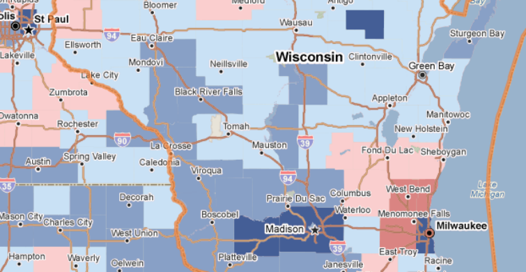
Which counties have the highest voter turn-out? Do those areas typically favor Democrat, Republican, or Independent candidates? How large or small have the margins of victory been in the past?
Try throwing in some additional data-sets as you speculate wildly… How has the population of the county or congressional district changed in recent years? Is it growing or shrinking?
How will the area’s demographics impact the election? Is the area racially and ethnically homogeneous or is there a sizeable minority population? How do the area’s income level and unemployment rate compare to the rest of the nation? What is the average age of residents?
While we here at PolicyMap can’t predict the outcome of elections, we do enjoy providing our users with interesting and reliable data. Have fun guessing, and if you’re eligible get out there and vote!