
147 Months of Unemployment Data Up-to-Date
One of PolicyMap’s most popular datasets is our unemployment rate data from the Bureau of Labor Statistics (BLS). Every month, the BLS releases employment and unemployment data for every county, CBSA, and state, plus most metropolitan divisions and cities. PolicyMap adds these updates as soon as they’re available. The BLS is also constantly modifying their historical data to account for new information they’ve obtained, and so every year, in addition to our normal monthly updates, we refresh all the unemployment data we have, including every month of every year since 2000, to account for changes to the data by the BLS. This is the reason that you may find a rate for a given place changes from time to time; it’s because it’s been updated.
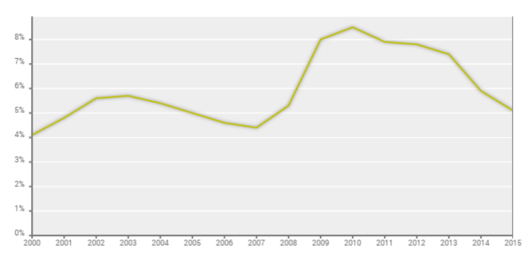
Additionally, we’ve updated the annual unemployment data, adding 2011 and refreshing all previous years.