
Annual unemployment data for local areas now available
Check out the annual United States unemployment rates and totals for your area. PolicyMap has labor force and unemployment data available at the county, state, and metropolitan area (CBSA) geographies. Or bring the most updated local unemployment data to your own website with PolicyMap’s free unemployment widget.
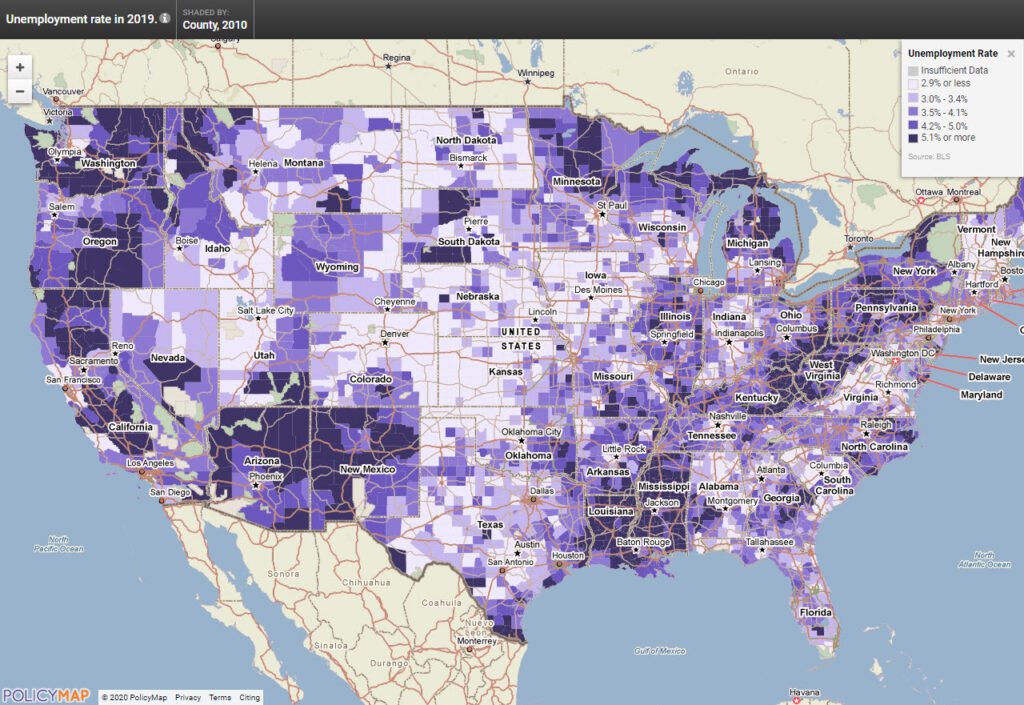
Loading an interactive unemployment map to your website is easy, just embed the code below. Your visitors can zoom in, pan around and click on any area to see the underlying unemployment statistics for every county in the nation. They can also toggle between months and years to see values for previous periods of time going all the way back to 2000. Darker shades on the map identify counties with higher rates or numbers of unemployed persons. Click on the map below to try it out:
To bring this dynamic mapping experience to your site, just embed the HTML code below onto your website.
<div style=”text-align:center”>
<iframe src="https://www.policymap.com/embedmap_dyn?lqid=497350&ew=1280&eh=720&etitle=true&elegend=true" named="embeddedmap" scrolling="no" marginheight="0" marginwidth="0" frameborder="0" style="border:0" width="100%" height="720" ></iframe>
<div style=”font:13px arial,geneva,helvetica,sans-serif”>Data mapped by <a style=”text-decoration:underline” target=”_blank” href=”http://www.policymap.com”>PolicyMap</a>, an online GIS mapping tool.</div></div>
As always, call us at 1-866-923-MAPS (6277) or email with any questions. We’d love to hear from you!