
HUD Launches PolicyMap Widget on NSP Resource Exchange

Note: If you’re looking for NSP data, we removed it from PolicyMap in February 2017. If you miss it, please send us a note: info@policymap.com.
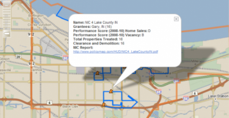
The Reinvestment Fund and PolicyMap have been engaged with HUD in the geospatial analysis of clustered Neighborhood Stabilization Program (NSP) investment across the country. The engagement is designed to study how markets treated with a concentration of NSP investment have changed over time compared to similar markets that have only minimally or not been touched by NSP. These findings are then displayed in a series of interactive, online maps and reports, powered by PolicyMap, at the cluster level, and at the grantee level. These tools, which will be updated on a quarterly basis, are designed to assist grantees and HUD in understanding how markets in which they are investing are changing over time, and eventually how certain types of investment might affect NSP target areas. To learn more about the purpose of the NSP program and to check out the interactive maps and report, visit NSP Investment Cluster (NIC) Reports.
