
New NMTC Application Data on PolicyMap
 This year, there’s a new secondary criteria in the Community Impact section of the New Market Tax Credit application. The Healthy Foods Financing Initiative Designated Food Deserts data was added to PolicyMap in June, and now it’s available in a simple yes/no format in the NMTC section of the Federal Guidelines tab.
There, you can quickly look up whether a given census tract is a food desert, or is not a food desert.
The Food Desert Locator is a project of the Economic Research Service, the economic information and research division of the U.S. Department of Agriculture. The Locator contains data about food access determined by the Treasury Department, Health and Human Services, and the Agriculture Department (USDA). A committee comprised of these three departments, along with staff from the Economic Research Service (ERS/USDA) determined a definition of food deserts used within the data and for determining eligibility for HFFI funds.
Low access is defined in this study as (a) in urban tracts, the percentage of people that live more than one mile from a supermarket or large grocery store or (b) in rural tracts, the percentage of people that live more than 10 miles from a supermarket or large grocery store. These data were published by the Economic Research Service (ERS/USDA) as a part of a 2009 report to U.S. Congress. In the 2009 report, the ERS used 1-kilometer square grids as the base of the analysis as a method for measuring distance from the nearest source of healthy foods. To learn more, visit our data directory.
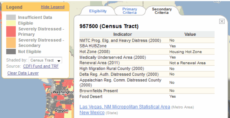
Also, in addition to updating PolicyMap, this new data is available on our widgets as well. The widget for Novogradac & Company (available at http://www.novoco.com/new_markets/resources/maps_data.php) shows, in one click, all the eligibility criteria for a given census tract in a pop-up bubble. And it now includes food desert data.

![]()