
Where are the Data on America’s Physical Infrastructure?
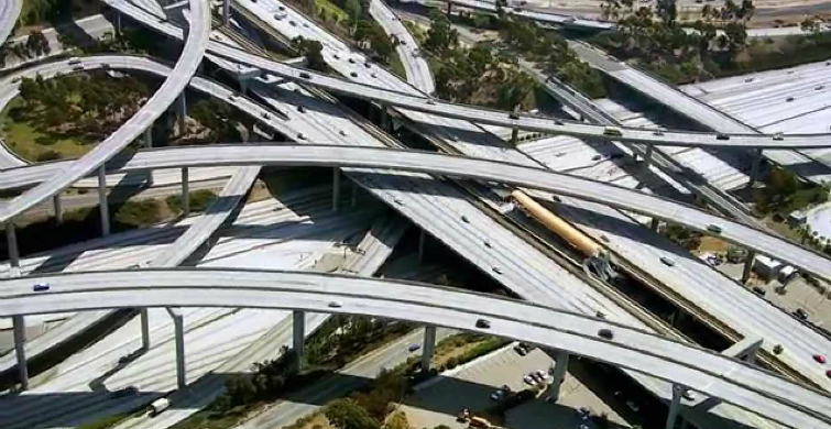
How we move ourselves and our resources as a nation is a critical and complex system. Our economy relies upon the efficient movement of goods, information and people, which in turn rely on the infrastructure supporting this transport.
Seeing as the current condition and future viability of our nation’s infrastructure has important public safety, economic, health and social implications, it would seem that having a central database on infrastructure systems would be of great value. Moreover, in their 2013 Report Card, the American Society of Civil Engineers (ASCE) gave America’s infrastructure a fairly dismal grade of D+, or “Poor: At Risk”. This wasn’t quite the vote of confidence that most of us would feel comfortable with.
So, seeing these potential gaps and opportunities, some of us at PolicyMap looked into the availability of infrastructure data, specifically if there were spatial datasets that could allow municipalities, organizations, and residents to know more about the condition of local bridges, roads, and waterways, for example.
Unfortunately, there wasn’t a central database or map at all; instead, infrastructure data exist as a patchwork of different datasets from different sources covering different areas of the country. The good news is that depending on the type of infrastructure system you’re interested in, some national datasets are publicly-available. Here’s a quick summary of some of the more useful and easily-retrievable datasets:
• Bridges (FHWA/BTS)
• Roads (FHWA/BTS)
• Aviation Delays (BTS, DOT)
• Dams (FHWA/BTS)
• Brownfield Sites (EPA)
• Superfund Sites (EPA)
• Parks and Recreation (USGS GAP PADUS Database)
• Airports and Runway (FAA)
• Major Ports (FHWA/BTS)
• Pipeline and Hazmat Incidents (PHMSA DOT)
Some infrastructure data are easier to find at the municipal level, as some cities are leading the way in both collecting and releasing data on their infrastructure systems and capital improvement projects (CIPs). In particular, San Francisco has an interactive map of their CIPs, paving sites and green infrastructure locations. Their 10-year plan also includes a handful of informative maps on street improvement locations, water and wastewater system pumps, pipes and hydrants, as well as charts on funding allocations and needs. CALTRANS, the Department of Transportation in California, also provides geospatial data on transportation improvement projects, bridge locations and the rail network.
So what’s the take-away message here? Well, it seems that in order to accurately assess the current state and plan for future demand, having a centrally-accessible source of infrastructure projects would be extremely valuable and informative. But, it’s worth recognizing that this scale of a project would require massive organization, reporting and perhaps even an Act of Congress. We’ll wait and see.
What did we miss? How is your city or community accounting for its infrastructure?