
Preparing for Disasters with Socially Vulnerable Populations
Data
Social Vulnerability Index
Source
Find on PolicyMap
- Quality of Life
- At-Risk Populations
- Social Vulnerability Index
- Overall Social Vulnerability
- Socioeconomic Status
- Household Composition and Disability
- Minority Status and Language
- Housing and Transportation
In the event of natural disasters and extreme weather events, some groups are especially prone to poor health, hospitalization, or even death, due to their socioeconomic status, household composition, limited English-speaking ability, substandard housing, or substandard transportation. These groups are considered socially vulnerable populations.
The CDC created a Social Vulnerability Index (SVI) by identifying the specific populations most at risk because of their socioeconomic status, household composition, minority status and language, or housing and transportation.
It is important to note that a neighborhood with high social vulnerability is not necessarily at higher risk of being impacted by climate or weather events. Information on social vulnerability should be combined with information on a neighborhood’s exposure to risk factors to identify areas that may need additional assistance before, during, and after a disaster. For example, a neighborhood along the Gulf Coast with a large elderly population would be at greater risk of harm from hurricanes than a similar neighborhood further inland. Go to https://toolkit.climate.gov/steps-to-resilience/assess-vulnerability-risks for more information on vulnerability and exposure.
Categories of Social Vulnerability
Socioeconomic social vulnerability includes low income households, those with low educational achievement, and areas with high unemployment who may not have the financial resources to recover from an extreme weather event.
Vulnerability due to household composition includes people with disabilities, older adults, children, and single parent households—people who may face health risks or challenges with evacuations or sudden moves.
Minority status and language includes those who identify as a race other than non-Hispanic White—people who have traditionally faced inequitable access to resources and power structures in the U.S.—and those who speak English less than very well, who may have trouble accessing information and need translation services.
Housing and transportation includes people who live in large apartment buildings or group quarters such as dormitories or prisons, people who live in mobile homes, and people who do not have access to a vehicle. These groups may have difficulty heeding evacuation orders.
Each of these four categories of vulnerability contributes to the overall Social Vulnerability Index. Research has shown that high SVI values correlate with worse health outcomes from natural disasters, including heat waves, tornadoes, and hurricanes (Bakkensen et al 2017).
A Look at Louisiana
The CDC has outlined an approach for emergency managers to create more resilient communities by defining, locating, and reaching at-risk populations, relying in part on the SVI. The overall vulnerability score can be used to locate neighborhoods or regions with high concentrations of at-risk populations, and the four categories provide detail on specifically how those areas are vulnerable, which points the way towards interventions.
For example, if a local government or organization is interested in improving community health before, during, and after hurricane evacuations in the southeastern United States, they could use the SVI to identify focus areas along the Atlantic or Gulf coast. Viewing SVI along with flood zones shows two large coastal area with major overlaps—an area southeast of Tallahassee, Florida, and much of the Louisiana coast.
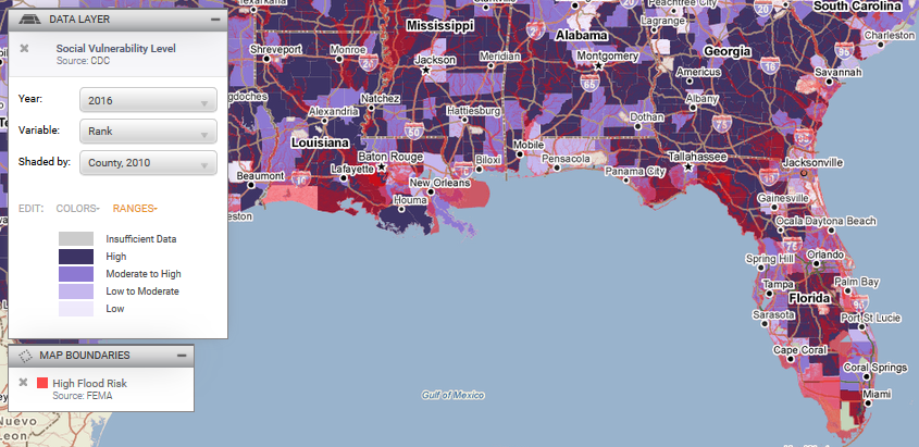
The Louisiana area is not only a highly socially vulnerable area with large flood plains, but also has several densely populated areas surrounded by flood zones (unlike the Florida area, which is mostly wildlife reserves).

A closer look at Baton Rouge reveals that much of the city along the Mississippi is highly socially vulnerable, but the ways in which it is vulnerable varies by neighborhood. In the household and transportation category, neighborhoods along the eastern bank of the Mississippi are highly vulnerable, and may need evacuation assistance in case of flooding.
People in the northeastern sector of Baton Rouge, in contrast, are more vulnerable due to their household composition and disability status.
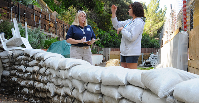
After defining and locating vulnerable populations, the next step is to reach people. In order to get people the information they need, some neighborhoods may need outreach through established community groups, translation services, or non-traditional meetings times for public meetings, or other unique targeted intervention strategies. Baton Rouge, for example, has a high population without a computer and without any kind of internet access. This indicates that any public service campaigns or emergency outreach plans should include print, telephone, or in-person communication.