
Washington Post Uses PolicyMap Data to Examine Health Inequities and COVID-19 Risk
This post is part of a series providing publicly available maps, data, and insights to answer COVID-19 questions in your community. For more COVID-19 resources, go to PolicyMap Special Edition: COVID-19.
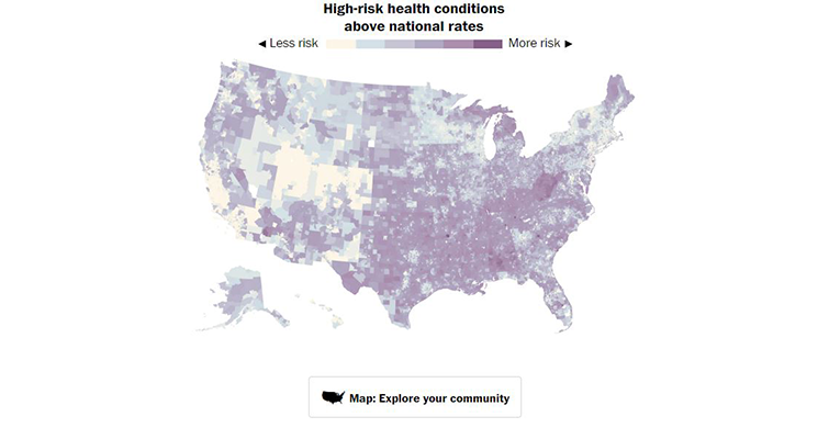
In an article titled “How the Coronavirus Exposed Health Disparities in Communities of Color,” the Washington Post cites PolicyMap’s exclusive estimates of underlying health conditions. The article illustrates through maps that majority-minority census tracts often have higher risks for severe COVID-19 illness.